Wild Weather brings Snow
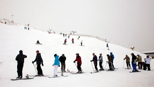
LISA WILTSE PEAK INTEREST: Long queues of skiers make the most of the first snow dump at Coronet Peak today Snow bunnies will rejoice, leaving the rest of us to huddle in front of the fire as a cold front sweeps the country ahead of the weekend. A strong and unstable westerly is expected to bring gale force winds and heavy rain to most of New Zealand tomorrow, with snow expected to low levels and thunderstorms likely. Ski fields have already experienced some snowfall, with slopes in the South Island covered in between 10 and 20cm of fresh falls overnight. The Remarkables ski area manager Ross Lawrence said light snow fell in the area this afternoon. "We're certainly enjoying it, the place has gone white, it's still filling in the tussocks so nothing new is opening," Lawrence said. "It'll be interesting to see how much we can accumulate. MetService forecaster Ian Gall said more snow was likely as the front moved. "The further west the skifields are, the more likely they are to be seeing snow," Gall said. Fiordland and south Otago could expect snow as low as 300m in the coming days.
| ||


Get Skype and Phone us for free